Nonthaburi Waterfront Living Survey Exploring Bang Kruai Canal Heritage and Temple Land Lives
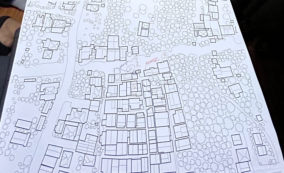
A canal can look quiet from the road, yet hold centuries of movement, memory, worship, and daily work. That is what makes the Nonthaburi Waterfront Living Survey, conducted from September 21 to 26, especially valuable.
The survey focused on communities along the Bang Kruai Canal, a waterway that connects the Om Non Canal with the Chao Phraya River. This area is more than a scenic waterfront. It is a living record of old settlement patterns, temple-centered landholding, and the changing demands of life beside the water.
Bang Kruai Canal links water, trade, and settlement
The Bang Kruai Canal sits within a wider network of waterways west of the Chao Phraya River. Before roads became the main routes of travel, canals shaped where people lived, traded, prayed, and farmed.
Its connection between the Om Non Canal and the Chao Phraya River gave nearby communities access to larger routes of movement. Boats carried food, building materials, temple supplies, and families traveling between settlements.
This geography explains why homes, temples, piers, and small paths grew close together. Waterfront settlement was not an aesthetic choice. It was practical, social, and economic.
Late Ayutthaya roots still shape the area
The survey also brought attention to the area’s historical ties to the late Ayutthaya period. Nonthaburi’s canals and riverside communities formed part of a broader cultural zone connected to royal-era trade, agriculture, and temple patronage.
Temples around the canal are key to understanding this past. Many served as spiritual centers, gathering places, and markers of settlement. Their grounds, halls, and river-facing locations reflect a time when religious life and water transport were closely linked.
The surrounding temples are not only monuments. They remain active places within the community. That continuity gives the area a rare depth. Past and present occupy the same narrow lanes, piers, and shaded temple edges.
Waterfront living is beautiful and demanding
Life along the canal carries clear strengths. Residents can stay close to long-held community ties, familiar temples, and the rhythms of the water. Houses often open toward the canal, with steps, platforms, or small docks linking homes to the shoreline.
Yet waterfront living also brings pressure. Residents face upkeep related to moisture, flooding, erosion, limited access, and changing building needs. Some homes must adapt to aging structures. Others face questions about repairs, inheritance, and whether younger generations can remain.

The survey’s value lies in recording these conditions before they fade into general assumptions. Waterfront heritage is not only about preserving old buildings. It also means understanding how people cook, commute, maintain homes, share space, and negotiate change.
Temple-owned land shapes everyday decisions
One of the most important realities in the area is the land leasing system tied to temple-owned land. In many older Thai communities, temples have long held land that residents lease for housing or small-scale use.
This system can help families remain near ancestral communities without owning the land outright. At the same time, leasing affects long-term decisions. Residents may weigh whether to invest in repairs, expand a house, or pass a home to the next generation.
These arrangements require careful documentation. They sit at the intersection of religion, law, community memory, and household security. A survey can help clarify how residents understand their rights, duties, concerns, and hopes.
Kasetsart University helps document a fragile way of life
The collaboration with Kasetsart University’s Faculty of Architecture adds an important layer to the work. Architecture students and researchers can record building forms, canal edges, materials, settlement patterns, and community use of space.
Their role is not only to measure structures. It is to listen, observe, and interpret how architecture supports daily life. A home beside the canal is part dwelling, part threshold, part family archive.
Done well, this kind of survey can support future planning that respects both heritage and residents. It can help temples, communities, educators, and local agencies discuss conservation with clearer evidence.
A canal community worth knowing carefully
The Bang Kruai Canal community shows how history survives through ordinary routines. A temple lease, a wooden stair, a boat landing, and a shaded wall can all carry meaning.
The Nonthaburi Waterfront Living Survey matters because it treats the area as a living place, not a frozen historic site. Its strongest lesson is simple: preserving waterfront heritage begins with understanding the people who still call the water’s edge home.


Comments